


AI-fueled Geospatial Analysis Might Change the World. And Save It.
The collection and analysis of geospatial data historically have been time-consuming, prone to human error, unwieldy and even risky.
The hours spent surveying land or researching records. The sheer amount of data coupled with unconscious bias creep as people yearn to move things along quicker. The errant assessment that could put a pipeline or a person in harm’s way.
Artificial intelligence is forging a better way. While relatively new to the geospatial industry, AI enables professionals in various fields to work more efficiently and accurately, respond to issues more quickly and, frankly, save money. Property insurers can better pinpoint risk. Lenders can expedite loans to farmers. Utilities gain better insight into where and where not to place electric transmission lines.
AI takes layers of complex data and imagery to deliver insights more accurately and quickly than people can.
The promise and problem of geospatial technology
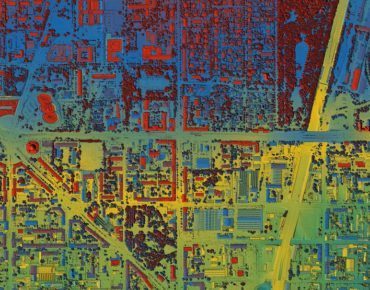
Geospatial data can quite literally be a mountain of information. GIS maps. LiDAR imagery. Survey records.
And complex. Remote sensing data acquired from satellites requires processing before it is even useful to most researchers and other users. A single data source typically is insufficient, so modeling often requires piecing together disjointed sources. Unearthing the most crucial takeaway can be the proverbial needle in a haystack.
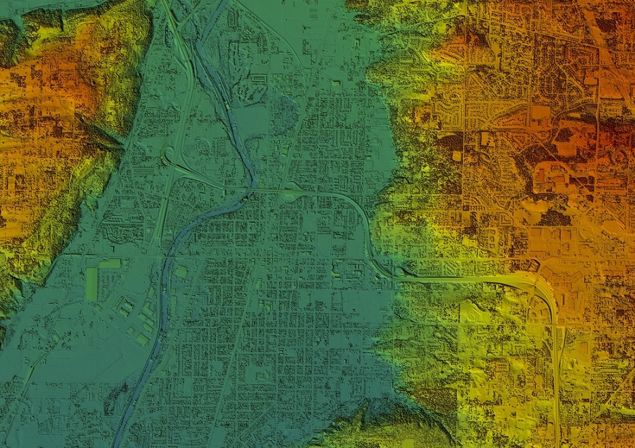
Digital elevation model. GIS 3D illustration made after proccesing aerial pictures taken from a drone. It shows lidar scanned, huge urban area of a city with roads and junctions between dense blocks (Shutterstock)
Geospatial analytics requires multiple steps and specialized skills. You need to collect the data from various sources and turn it into multiple layers of visual representations, mapping. Sources include earth observation, geographic information systems (GIS), global navigation satellite systems, and 3D scanning using drones.
You need to analyze the maps to identify patterns. The process can require remote sensing and image processing tools, cartography skills and other specialized talents, and specific programming languages.
Companies want the insights from geospatial data but a much easier way to find them. Enter evolving technology. By next year, Deloitte reports, 36% of large and midsized organizations are expected to have deployed location intelligence software, up from 10% in 2019.
Meticulous Research reports that the use of AI-based GIS solutions by different industries is rapidly advancing the data gathering and cleansing process to improve predictive accuracy. How rapidly? The compound annual growth rate of the geospatial analytics market is expected to be 17.6% from 2021 to 2028 and reach $256 billion.
That’s a lot of needles.
AI unlocks the potential of geospatial data
Deloitte notes where applications are headed. Corporations optimizing their supply-chain network. Governments improving land management practices. Utilities managing risk from vegetation along its power lines.
Technology solutions are leveraging AI to take action sooner, save money and ensure safety. AI can handle the menial tasks, analyze vast amounts of data points, improve accuracy and yield timely takeaways.
Through automation, AI can extract information and deliver insights in real-time. AI algorithms can predict wildfire risk, identify wetlands, classify vegetation types to assess reclamation activities, detect where vegetation encroaches on powerlines, and provide untold applications.
For example, the technology helps energy companies understand their pipelines' exposure to environmental risks such as landslides and flooding and where to best prioritize their monitoring efforts. The energy company is a better steward of the environment, saves money, and helps ensure public safety.
The old ways of doing business are insufficient. Traditional climate modeling, for example, can be too broad and too dated. A years-long trend of higher precipitation can be less valuable than knowing specifically where soil erosion presents a looming landslide risk to infrastructure. Rather than requiring a boots-on-the-ground evaluation, a team using AI to analyze information from LiDAR imagery can assess the impact without putting a person in harm’s way.
What the future holds
 Think of the possibilities ahead as geospatial technology and imagery continue to improve. Look no further than your pocket to see how far we’ve come in a relatively short period of time. What’s the best camera you have? Your mobile phone. What’s the best satellite navigation system you have? Your mobile phone.
It’s no coincidence that AI is now helping to analyze satellite imagery to understand climate change better. “Our goal is to pioneer novel combinations of deep learning algorithms with decades of physical knowledge to create a synthetic high-resolution satellite imagery of surface melting in the Antarctic,” said Guido Cervone, associate director of Penn State’s Institute for Computational and Data Sciences.
An AI-led approach to geospatial analytics will revolutionize how many professionals get work done — more efficient, accurate, timely, and safe. More insightful. That, in turn, will transform their industries. And the world.
 About the Author
Toby Kraft believes in market-based solutions for global sustainability and has built a career by analyzing environmental data that can solve real-world problems. He co-founded Teren to cultivate a company culture and mission to transform data into solutions for a safer and more sustainable planet. Toby extends his passion for innovation to the outdoors, where he’s happy skiing on the remote mountains of Colorado.


