


IoT Goes to Sea—Via Satellite
A planned satellite network designed to help cargo ships chart courses through new shipping lanes full of melting sea ice is scheduled for launch in 2022.
The new research project dubbed Maritime IoT will launch a constellation of 50 small satellites based on emerging communications technology called VHF Data Exchange System, or VDES. The radio communications system connects ships and shore stations via satellite.
A consortium of satellite communications specialists said they are developing the network of low-earth orbit satellites that would be used to fill communications gaps as more ships used newly-opened shipping lanes in and around the Arctic Ocean.
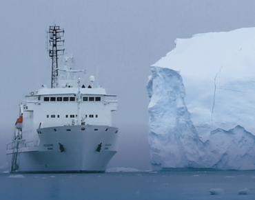
Maximum sea ice in the Arctic has steadily receded in recent years as average global temperatures rise. That has opened new but hazardous shipping lanes that could greatly reduce the time and cost of shipping goods.
The Maritime IoT efforts seeks to boost access to navigation data and high-bandwidth communications in a “high-latitude seas” that currently lack network capacity. Current networks are often expensive, unable to handle moderate amounts of data, often leaving remote regions uncovered, organizers said.
The consortium behind the project is headed by the Danish satellite operator Sternula. The satcom developers include Denmark’s GateHouse Telecom, Space Inventor, Satlab and Aalborg University. The Danish Meteorological Institute is also participating in the maritime project.
VDES is the second generation of the Automatic Identification System, a tracking platform used to monitor marine traffic. VDES was developed to extend the system’s range and expand bandwidth to handle more data. “VDES will enable global connectivity through satellite networks as well as efficient transfer of more data types,” project organizers said this week in announcing the new maritime satellite network.
Per Koch, business development manager at GateHouse Telecom, said the VDES standard was assigned global radio frequencies last year. “We now have the opportunity to launch the first global VDES network improving navigation services and security for ships sailing through treacherous passages,” Koch said.
The planned satellite constellation will initially deliver ice chart data to ships that are using newly-opened shipping lanes around the Arctic Ocean. The satellites would relay ice chart data to ground stations that would use coastal VHF radio stations to transmit data to ships equipped with a VHF receiving antenna. The network also would allow communications between ships, including their relative positions based on GPS navigation coordinates.
The maritime network could also be used to collect and transmit data on ship propulsion and other critical systems. “Smart buoys” could also be linked to the network to provide measurement data, the organizers said.
GateHouse, the Danish data communications specialist, said it is developing advanced algorithms designed to route data within the satellite constellation, ground stations and across the maritime network.


